|
|
Directions From interstate 210, exit Lincoln Ave. north.
Drive north for 3km (2 miles), to Loma Alta Drive, turn right (east).
Go exactly 1km (.6 miles) east on Loma Alta, and turn left on Chaney Trial.
Drive up just 300 meters. Park in front of the giant plant nursery.
We will drive to the trial head in those cars that have State Park permits.
|
|
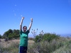
The Good You will feel this hike the next day.
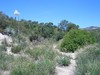
Amazing view. Stunning river bed, giant acorns, an actual mine (small).
|
|
The Bad You will feel this hike the next day. |
|
Where Altadena, sort of north of Pasadena. |
|
Notes Three are two hike trails that start from the same place. This one, and the second one called the Mt. Lowe Railway Bed.
This trail is tough. There is a little bit of climbing included. You have been warned.
Dawn Mine, one of the San Gabriel Mountains' most promising gold prospects, worked from 1895 through the 1950s?
And what about Millard Canyon Falls, a 50-foot waterfall on the south wall of Millard Canyon, just 2 miles west-norh-west of our usual hiking trail --- the Sam Merrill Trail -- up Echo Mountain.... the hike we call "Mt. Lowe"?
Did you think the Cape of Good Hope refers only to an ocean inlet marking the border of the Atlantic and Indian Oceans off Cape Town in South Africa? Actually, the Cape of Good Hope also refers to a rocky knob that appears on the Dawn Mine trail at its east-most point, where it intersects with the Sunset Ridge Fire Road.
That's also the point where the trail intersects with the former Mt. Lowe Railway Bed. A half mile later, and the Dawn Mine trail will take us down into Millard Canyon. The trail is a reworked, primitive version of the original mule trail used to haul ore from the Dawn Mine, on mules, up to the railway bed.
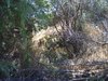
This section of the trail involves "shady and gloomy" canyon, flotsam and jetsam from the mining days, the actual gaping entrance to the mine's lower shaft, crystalline mini-pools, and around the bend, a private cabin, before rejoining Sunset Ridge Fire Road.
|
|
| More details |
(Hikers have been notified by email) |
|